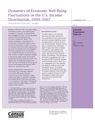
US Census Report: Fluctuations in the U.S. Income Distribution: 2004-2007

This U.S. Census report divides the nation’s 106 million households into quintiles of 21.3 million based on income and compares their characteristics and their movements between and within the quintiles. Using data from the Survey of Income and Program Participation (SIPP), the report traces the changing income levels of a representative sample of U.S. residents over a 48-month period (February 2004 to January 2008). These households were interviewed every four months over this time.

View the full report in PDF format at: http://www.census.gov/prod/2011pubs/p70-124.pdf

Technology Survey for Undergraduates @ UConn

Are you a tech-friendly undergraduate? If so, we are conducting a survey to find out what technologies you use and prefer. Taking the short survey could net you a $50 gift certificate to the Co-op!

Note: Participants must be 18 years or older and currently enrolled at the University of Connecticut as an undergraduate to participate in this survey.

2010 Census Redistricting (Public Law 94-171) shapefiles now available

Thanks to the efforts of Jeffrey Dunn & Jie Lin at the Connecticut State Data Center and Will Carnes and Josh Strunk at the UConn Libraries Map and Geographic Information Center – MAGIC, shapefiles are now available for the 2010 U.S. Census Redistricting (Public Law 94-171) dataset for Connecticut. These shapefiles incorporate the data and are available in both Connecticut State Plane NAD 83 and WGS 1984 projections. Included below is a listing of the geographies available for download in shapefile as well as spreadsheet formats.

Each of these shapefiles include FGDC metadata which defines each attribute and users can also download the spreadsheet data which includes a codebook for these attributes. To download these files visit the Connecticut State Data Center’s data download page at:
We would also like to feature maps on the MAGIC and Connecticut State Data Center websites that included 2010 U.S. Census Redistricting (Public Law 94-171) Data created by you! If you have a great map you would like to share email us at ctsdc@uconn.edu.

May 3-4, 2011 – GIS & Public Health Conference

Registration is now open for the 7th Annual GIS & Public Health Day to be held at the University at Albany School of Public Health in Rensselaer, NY on May 3, 2011. The theme of the conference is “GIS and Community Health Planning” and this year’s keynote presentation “All Public Health is Local: The Community Perspective on GIS and Public Health” is to be given by Dr. Russell Kirby from the University of South Florida.

Registration and additional details on this event are available at: http://www.albany.edu/sph/cphce/gis_2011.shtml

Participants can also register for training day sessions to be held on May 4, 2011 at the University at Albany School of Public Health in Rensselaer, NY

If you have any questions about the conference, they can be sent to the School of Public Health Center for Public Health Continuing Education at: coned@albany.edu

Teaching with Spatial Technology Workshop (TwiST) workshop June 28-30, 2011

Want to engage your students in activities that will have them asking questions and thinking critically about content you cover in your educational environment? At the Teaching with Spatial Technology Workshop (TwiST), K-12 and college educators will learn how to teach with ArcGIS, GPS and other geospatial technologies in their educational environments. Participants will collect and gather data for a community mapping project while learning how to connect to state standards.

Celebrating its 10th year, TwiST will be held June 28-30, 2011 at Cayuga Community College in Auburn, NY. Registration is $250 before May 3 ($275 after May 3). The fee includes: 3-days of training, lunch, a notebook of materials, data, the opportunity to obtain an discounted geospatial software and tools, and approximately $1,000 worth of additional GIS learning resources. Both Graduate and Undergraduate credit is available for an additional fee.

The registration deadline for TwiST is May 3 for the discounted rate. Visit www.iagt.org/twist for registration and additional information.

Get MicroData from the DataFerret!

DataFerret is a tool that mines and extracts data from 4 main types of data:

  • MicroData
  • Aggreagate or Summarized Data
  • Longitudinal Datasets
  • Time Series Datasets

This tool is very easy to use and may be helpful to user of PUMS data.  The program has the ability to export custom tables in a number of different formats and has the ability to create maps.

Check out the following links to get some more background information on the DataFerret and how to make use of this tool:

Here is a sample map of Average Income by PUMA’s in Connecticut, no GIS needed.

ACS 2005-2009 PUMS Data for Average Income