The Connecticut State Data Center has been working on visualizations that highlight some of the data available on the Connecticut Open Data Portal.
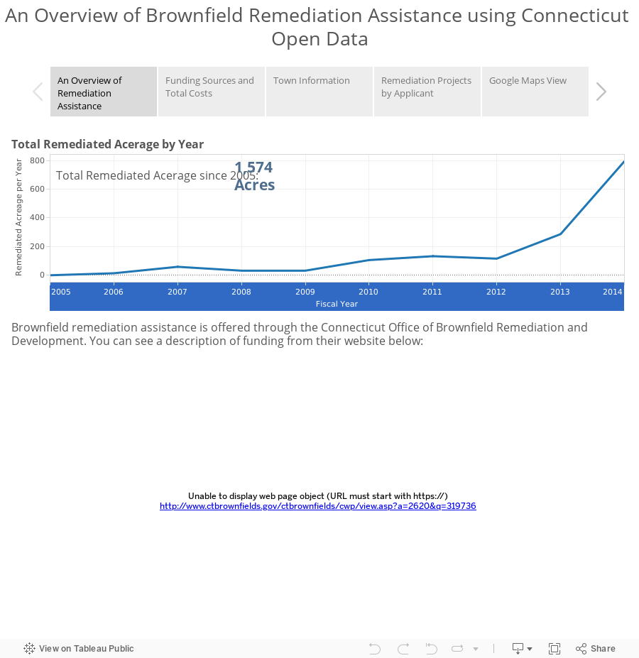
This third visualization uses data to provide an overview of brownfield remediation around the state, focusing in particular on projects that have received funding assistance from different government sources. In all, there are 173 financially-assisted remediation projects featured since 2005. You can see the original data here.
Using this visualization allows you to see what projects are happening where, who’s funding those projects, and how much land is being reclaimed and for how much. One page provides an interactive pie chart that can be filtered by municipality and span of time, allowing for comparison of funding sources in different periods and places. One map focuses on remediation assistance applicants; the filters on this map allow for viewing certain projects based on applicant municipality or applicant name. As with previous visualizations, there’s also a GoogleMaps interface that allows for seeing the remediation sites with a satellite basemap and Google Street View.