Category Archives: GIS
Pizza, (Root)Beer, and GIS Workshop – June 21, 2012
For additional information visit the Connecticut GIS User to User Network website at: http://ctgis.uconn.edu
Using GIS to Evaluate Vulnerability to Climate Change: A Case Study of Martha’s Vineyard
Dukes County, Massachusetts is composed of the county subdivisions on the island of Martha’s Vineyard and the Elizabeth Islands, which form the town of Gosnold. A few weeks ago, I completed my M.A. thesis in the Geography department which investigates where climate change could impact Dukes County. My study evaluates vulnerability to climate change through the examination of social vulnerability and vulnerability to climate sensitive hazards (i.e. sea level rise and storm surge events) and is designed to coincide with the jurisdiction of the Martha’s Vineyard Commission. The thesis includes maps created in ArcMap, with data from MassGIS, that locate vulnerable areas in the county as well as quantify the potential impact of hazards on specific land use categories. Additionally, a social vulnerability index quantifies vulnerability based upon demographic data from the 2010 Census and 2010 American Community Survey.
The overarching goal for this project was to develop a theoretical framework that serves as a GIS-based decision support system for policy makers to determine where climate change adaptation policies are needed. This framework is operationalized through a case study of vulnerability of Dukes County, Massachusetts. The abstract of the study can be seen below:
Climate Action Plans (CAP’s) are recent innovations in policy that have been catalyzed by a need to adjust the relationship between human activity and the Earth’s climate system. CAP’s often are composed of methods to mitigate greenhouse gas emissions in addition to adaptation strategies. Research indicates, however, that many plans focus on mitigation strategies while adaptation policies related to predicted changes caused by climate change are often overlooked. This thesis presents an integrative framework for locating areas that are in need of adaptation strategies through a GIS based decision support system that visualizes vulnerability. It is operationalized through an empirical study of Dukes County, Massachusetts.
Dukes County is a New England county composed of the islands of Martha’s Vineyard and Gosnold. The county has a long history of commercial fishing, but more recently caters to affluent seasonal tourists. With both economic activities heavily reliant upon the ocean as a resource, climate sensitive hazards, such as sea level rise and tropical storms, pose an important risk to the population, built environment, and the natural environment that has made the study area a highly desirable New England tourist destination.
The results of my case study conclude that long term climate processes have shaped the way in which Dukes County has developed through the geomorphic influence of the last glaciation. The up-island towns of Martha’s Vineyard (Aquinnah, Chilmark, & West Tisbury) and Gosnold differ in geography- both physically and socially- from their down-island counterparts (Edgartown, Oak Bluffs, & Tisbury). This geographic variation results in an unequal distribution of vulnerability related to climate sensitive hazards distributed throughout the county, which have been identified as storm surge events in addition to chronic sea level rise. Generally speaking, my study concludes that…
Flatter land that is also lower in elevation down-island has traditionally been developed and inhabited more than the up-island land of Martha’s Vineyard and the islands of Gosnold. Consequently, larger populations and more developed land are at risk to hazards whose exposure is largely dependent upon elevation, like storm surge and sea level rise (down-island).
The full text of this study is now available online through Digital Commons@UConn: An Integrated Approach for Developing Adaptation Strategies in Climate Planning: A Case Study of Vulnerability in Dukes County, Massachusetts
NEURISA Day 2012 Call for Presentations – Now Open
- Mobile & Web Technology
- What’s New in GIS / Spatial?
- IT Trends (e.g. virtualization, cloud technology, open source)
- LiDAR
- Abstracts should be less than 300 words.
- Abstract must be submitted by July 2nd, 2012.
- Presentations cannot be product marketing.
- Please submit your presentations online at: www.neurisa.org/neurisaday2012abstract
The New England Chapter of the Urban & Regional Information Systems Association (NEURISA) is a professional organization that provides a forum for: promoting and facilitating the use and integration of spatial information technology, fostering relationships, professional development, and representing the interests of Geographic Information System (GIS) practitioners and Information Technology professionals across the New England region.
URISAis an international association for professionals using GIS and other information technologies to solve challenges in state/provincial, regional and local governments.
Sharing Spatial Data in New England: Policies, Technology, and Trends Webinar
Interested in learning more about policy, technology, and trends in sharing spatial data in New England? NEURISA is offering a free webinar on Tuesday June 5, 2012 from 10:00am-11:30am which will feature 3 presentations on sharing spatial data. Included below is the agenda for this webinar.
Agenda:
Introduction and Overview of Town of Amherst GIS Data Sharing Program – Michael Olkin, Town of Amherst GIS Administrator and NEURISA President
From Public Records to Open Government: Access to Massachusetts Municipal Geographic Data Robert Goodspeed, MIT Department of Urban Studies and Planning.
2011 Storm Season Opens Doors to Data Sharing with Utility Companies Meghan McGaffin, GIS Analyst City of Milford, CT; Editor, CT GeoFocus; Municipal Representative, CT GIS User to User Network.
When: Tuesday June 5, 2012
Time: 10:00am-11:30am
Cost: FREE!
Registration: To register visit: https://www4.gotomeeting.com/register/773331303
NEARC Spring Meeting – May 22, 2012
The Northeast Arc Users Group Spring Meeting will be held on Tuesday May 22, 2012 from 8:00am-5:00pm at Smith College in Northampton, MA. This meeting will feature multiple presentations on GIS, Spatial Analysis, Data Sharing, Census Data, and more and includes lunch for all participants!
Register soon to for the early bird discount. To register visit: http://www.cvent.com/d/lcqpjb/4W
For additional details on the schedule for the NEARC spring Meeting visit: http://www3.amherst.edu/~aanderson/nearc/schedule2012.html
This is a great meeting and if you are interested in learning more about GIS and geospatial technology plan to attend! This meeting is a great networking opportunity and we hope to see you there!
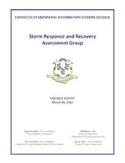
Connecticut GIS Storm Response and Recovery Assessment Group’s Findings Report
Using ArcGIS Online to Create and Share Interactive Web Maps — CLEAR workshop on June 7, 2012
2012 Northeast Arc Users Group Conference – Call for Proposals
Call for PresentationsThe Northeast Arc Users Group will hold its 27th Annual Conference, November 11-14, 2012 at the Samoset Resort in Rockland, Maine.
The 2012 NEARC conference will feature keynote sessions, vendor demonstrations, poster displays and over 60 technical workshops and user presentations. The conference is expected to attract over 500 users of Geographic Information System software including urban and regional planners, educators, natural resource managers, utility professionals and government agencies that use geographic information to help with decision-making and problem-solving on a daily basis.
PRESENTATION TOPIC AREAS
- Public Safety
- Municipal
- Education
- Emerging Technologies/IT
- Natural Resources
- Mobile Technology
- Facilities
ABSTRACT SUBMISSION REQUIREMENTS
- Presentations cannot market specific products and services.
- Abstracts should be 150-200 words.
- Presenters must register and pay to attend the conference at regular conference fees.
- Deadline has been extended until June 1, 2012
- Questions? Contact Brett Horr, Program Chair at bhorr@yorkmaine.org
CLICK HERE TO SUBMIT A PRESENTATION
For additional details on the NEARC 2012 conference visit: http://northeastarc.org/2012/index.html
Connecticut GIS User to User Network Meeting – Friday March 30 at UConn Greater Hartford and Online!
Looking to network with other GIS users in Connecticut? Want to know about the next steps for the Connecticut Geospatial Council?
Attend the Connecticut GIS User to User Network Meeting on March 30, 2012!
The Connecticut GIS User to User Network will hold their Spring Quarterly Meeting on Friday, March 30, 2012 at the University of Connecticut, Greater Hartford Campus at 85 Lawler Road West Hartford, Connecticut in room 104 of the Hi-Tech Classroom Building (HITC) [View Campus Map].
The meeting will start with networking opportunities at 8:30 AM and the first presentation will begin promptly at 9:00 AM. Among the presenters and presentations will be Mr. Tyler Kleykamp from the State Office of Policy and Management. He will be speaking on the recent Governor’s Bill Number 5027 regarding the impacts on the Connecticut Geospatial Council and future plans regarding GIS in the State of Connecticut.
Virtual Attendance via Live Stream!
For those of you unable to physically attend the meeting, you can attend this meeting virtually! To attend this meeting virtually please register via the link below. Participants registering for the virtual stream will be sent an email one day prior to the event with connection details and users will also be able to ask questions virtually.
Register Here for Virtual Meeting
Cost:
Free!
Parking:
Parking is available in the parking lot on Trout Brook Road [Map]
View the Live Stream at: http://ustre.am/J8GC or via the video window below. The live stream will begin at 9:00am on Friday March 30, 2012 and will end by 12:00pm.


