
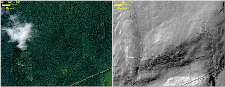
At top left, leaf-on 2012 aerial imagery from Connecticut (CTECO); top right is 2010 hillshaded DEM derived from LiDAR data showing stone walls, old road and building foundation; bottom is 1934 aerial photography (available from MAGIC and CT State Library)
New research by Geography graduate student Katharine Johnson and faculty William Ouimet was covered yesterday by National Geographic in their article “Lost” New England Revealed by High-Tech Archaeology. The article features a Q & A with Katharine Johnson, a PhD student in Geography and employee here at MAGIC and the Connecticut State Data Center.
You can read it (and see some cool graphics) here: http://news.nationalgeographic.com/news/2014/01/140103-new-england-archaeology-lidar-science
The article references a paper by Johnson and Ouimet that was recently accepted and published by the Journal of Archaeological Science about using Light Detection and Ranging (LiDAR) to identify and analyze the historic agricultural landscape of New England that is now hidden by the forest canopy in aerial photography but is visible using LiDAR. Check it out, here: http://www.sciencedirect.com/science/article/pii/S0305440313004342
Pingback: NASA Technology Used To Find Stone Age Structures - Universe Today