
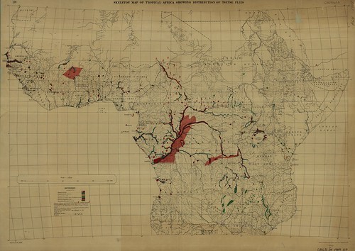
Map 1.) Skeletal Map of Tropical Africa Showing Distribution of Tsetse Flies
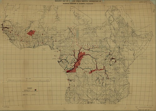
Map 2.) Skeletal Map of Tropical Africa Showing Distribution of Sleeping Sickness and Glossina Palpalis
Tsete flies (Genus Glossina) have several species that exist on the African continent. On Map 1 you can see that there are several species of Glossina listed. These species have slightly different habitats as shown below (click the links for modern day maps, how do they compare to the 1909 maps?):
- Glossina palpalis – are generally considered “riverine” species
- Glossina fusca – are generally considered “forest” species
- Glossina morsitans – are generally considered “savannah” species
There are many other species of tsetse flies, for a brief list, click here.
The actual parasite that the tsetse flies act as vectors for is the protozoa Trypanosoma brucei , more specifically African Trypanosomiasis.

Trypansomiasis can be a fatal disease that first causes the lymphnodes to swell, insomnia at night and fatigue by day (hence “sleeping sickness”). For a list of symptoms and stages of the illness click here. It was not until 1902-1903 that it was discovered by Sir David Bruce that the tsetse flies were the vector for this parasitic disease. This cognitive leap must have prompted the mapping of tsetse fly habitats and distribution to predict the occurrence of sleeping sickness and take initial steps in mitigating the disease. Turn of the century GIS!
Oh yeah, if you want some GIS data on tsetse fly distribution, check out this page sponsored by the FAO.