
This “Map of the Week” post was inspired by some maps that were given as a gift. Yes, the best maps are the ones freely given! These maps came to me by a friend at the WV GIS Technical Center a couple years ago.
The best thing about these maps is that they came with a book! The book’s title is “Annual Report of the State Geologist for the Year 1907” The reports included within are:
- the Newark Igneous Rocks of New Jersey,
- Notes on the Mineral Industry with Mineral Statistics,
- A report on the Improvement of Manasquan Inlet and,
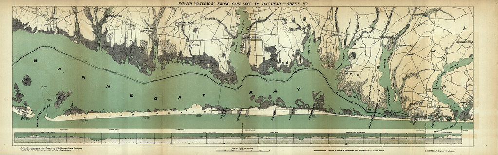
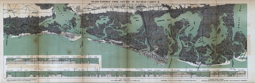
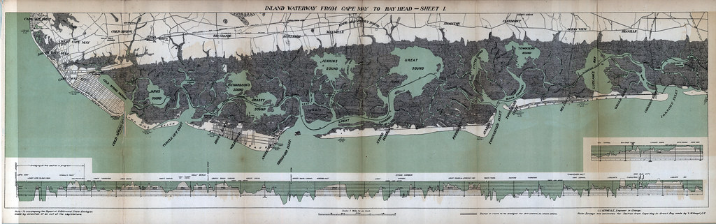
- A detailed report on an Inland Waterway from Cape May to Bay Head
The maps within outline the report on the Inland Waterway that may have more than a strong connection to the Intracoastal Waterway that was authorized in 1919 by the United States Congress. Below are the maps included with the text that can’t be found at Google Books or The N.J. DEP. As always the maps are available to download from MAGIC’s Flikr account! Click on the sheet title above each map for the corresponding Flikr page.

Additionally, you can view and download the report from the New Jersey Departement of Environmental Protection here. At the previous link you will have access to the Annual Report of the State Geologist for many different years.
If you want to examine current Intracoastal Waterway navigation maps, check out NOAA’s Office of Coast Survey Online Chart Viewer. This link will bring you to a portion of the New Jersey Intracoastal Waterway, while this link will bring you to an index of all the available charts for the Intracoastal Waterway for online viewing.