People often have the misconception that geographers and cartographers are not relevant because “everything has been mapped”. But the landscape is always changing! Here are some examples of significant changes in the state over the past century.
Click on the images to enlarge them.
Ocean Beach, New London: Prior to 1938, the maps show homes along with two bridges in the area. However, the hurricane of 1938 destroyed most of the homes and one of the bridges. The Ocean Beach Area was changed to a park after the hurricane, as seen in 1958 topographic map. See photographs of what Ocean Beach looked like in 1923 and now.

Ocean Beach in 1938

Ocean Beach in 1958
Downtown Hartford: In the early 1950s, Downtown Hartford looked very different without interstate highways going through the city. Interstate 84 was built along the city’s major rail lines. After the construction of I-84, much of the Park River, found near the state capitol and Bushnell Park, was diverted into underground channels. 
Downtown Hartford in 1952

Downtown Hartford in 1984
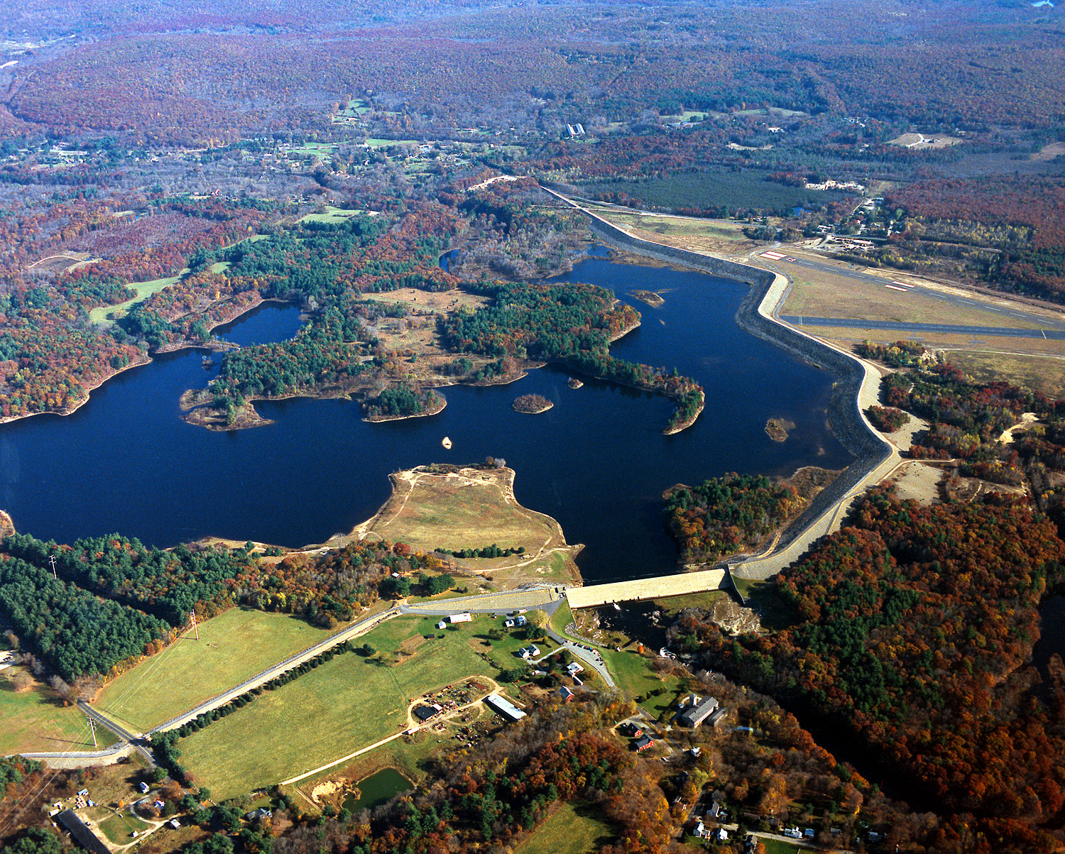
Mansfield Hollow, Mansfield: Mansfield Hollow Dam was built in 1952 by the Army Corps of Engineers to control flooding in the area. The large reservoir was created by damming the Natchaug River, which flooded a swampy area known as Turnip Meadow.

Mansfield Hollow in 1943

The Mansfield Hollow Area is shown below