Did You Know? #15 GeoMentor Seeking Educators

Outside the Neatline (overseen by the University of Connecticut Libraries Map and Geographic Information Center) is seeking a GeoMentor relationship with formal(public/private schools) and informal educators(Boy Scouts, Girl Scouts, etc…) in the state of Connecticut. What exactly does a GeoMentor do?

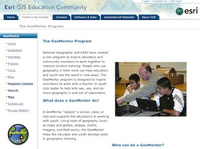
“A GeoMentor ‘adopts’ a school, class, or club and supports the educator/s in working with youth. Using tools of geography (such as maps and globes, atlases, charts, imagery, and field work), the GeoMentor helps the educator and youth develop skills in geographic thinking.” ~ GeoMentor.org

Since Outside the Neatline is integrated with MAGIC we can offer access to one of the nations premier map collections, online geospatial data, knowledgeable mapping professionals. We are eager to create learning opportunities that provide interdisciplinary research and learning experiences.

Please watch the video below featuring the release of the GeoMentor program and visit the website to learn more about the program at http://geomentor.org

If you have any interest or questions concerning the program please contact Jeff Dunn at:

jeffrey.dunn@uconn.edu
or
magic@uconn.edu

Please use “Outside the Neatline” in the subject line for both addresses.

Did You Know? #11 Cartography in the News

Political views aside, the following video is entertaining and impressive! Minnesota Public Radio edited and posted this video of Senator Al Franken of Minnesota and it’s worth watching.

Pause the video and compare it the following map provided by National Geographics Xpeditions Atlas page:


Not too bad, how does your geographic knowledge stack up? Click on the picture below to see CNN’s reporter Jeanne Moos provides an entertaining overview of Al Frankens ability. Pay attention to when she asks “can you find New York on a map?”.


If you’re out of practice on naming your states we’ll provide you with some fun online games that will sharpen those rusty skills (Thanks to Veryspatial.com for listing the first 3 links in their excellent blog!):

  • Place the States – In this game you’ll place the state shape where it belongs.
  • Name the States – This game is a little less difficult, just place the state name where it belongs.
  • CIA Worldexplorer – This game covers world geography at various levels and asks you to choose a country based on facts given to you. Good Luck!
  • Maps.Com – This page contains many online map quizzes and map games for different regions around the globe.

Try this quiz from Maps.Com:
<br> <p>Your browser does not support iframes.</p><br>
If you need to study up beforehand, we recommend National Geographics Xpeditions web site. Here you will find a link to an Atlas, Lesson Plans and Activities.

TEACHERS!
We at Outside the Neatline would like to show of your students knowledge of geography and map drawing skills. We would like to see student submissions from elementary school students or classes so we can post their work for the mapping world to see! We will leave the submission date open so that we can highlight your students hard work throughout the year.

You can submit your cartographic masterpieces in one of two ways:

(1) as a digital image attached to an email sent to: jeffrey.dunn@uconn.edu

OR

(2) in the drawings original paper format in the mail addressed to:

Map and Geographic Information Center (MAGIC)
Homer Babbidge Library
369 Fairfieild Way, Unit 2005
University of Connecticut
Storrs, Connecticut 06269-2005

Any questions or concerns can be answered by email at: jeffrey.dunn@uconn.edu Or by telephone at: (860) 486-4589