Connecticut Town Population 2010 & 2000 Interactive Map Now Available

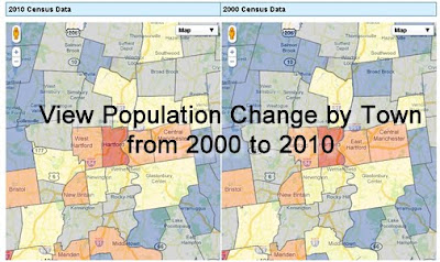
The Connecticut State Data Center has just released an interactive map to allow users to view 2000 and 2010 Census data for Connecticut towns. This map viewer allows users to search for a Connecticut Town, click on the town to view population, race/ethnicity, voting age, and housing data for 2010 on the map on the left and the user can view 2000 Census data for the town in the map on the right.

The 2010 data was released on 3/9/2011 at 2:00pm and we are still enhancing this mapping interface and we welcome your feedback! Check out this interactive map by visiting the Connecticut State Data Center’s website and click on the Maps link or click the image below
Users can also download this data in spreadsheet (Microsoft Excel format) and in shapefile formats directly from the Connecticut State Data Center’s data page.

Census Bureau Ships Local 2010 Census Data to Connecticut

Today (Tuesday March 8, 2011), the Census Bureau shipped local 2010 Census data to the governor and leadership of the state legislature in Connecticut. After confirmation of receipt, usually within 24 hours of shipment, the Census Bureau will issue a news release with five custom tables of data for the state. Wednesday’s release is expected around 2 p.m. EST. At that time, the full set of data will be available via FTP download at http://www2.census.gov/census_2010/01-Redistricting_File–PL_94-171/. Within 24 hours after release, the data will be posted on the Census Bureau’s new American FactFinder site http://factfinder2.census.gov.

The data will include summaries of:

  • Population totals
  • Race
  • Hispanic origin
  • Voting age

Data will be available for multiple geographies within the state, such as census blocks, tracts, voting districts, cities, counties and school districts.

Census Bureau to Release Local 2010 Census Data for Connecticut

Next week (March 7-11, 2011), the U.S. Census Bureau anticipates releasing local-level 2010 Census population counts for Connecticut. This data released by the Census Bureau will provide summaries of:
  • Population totals
  • Race
  • Hispanic origin
  • Voting age

This data will be released for multiple geographies within the state, such as census blocks, tracts, voting districts, cities, counties and school districts.

According to Public Law 94-171, the Census Bureau must provide redistricting data to the 50 states no later than April 1 of the year following the census. As a result, the Census Bureau is delivering the data state-by-state on a flow basis in February and March. All states will receive their data by April 1, 2011.
When will this data be released?
Each state’s geographic products and redistricting data are first delivered to the state’s leadership, such as the governor and majority and minority leaders in the state legislative body. Upon confirmation of delivery to the state leadership, the US Census Bureau will release a news release with five custom tables of data. Within 24 hours, the full set of five detailed tables will be available to the public online via the American FactFinder.
For more information on the Census Bureau’s Redistricting Data Program, visit http://www.census.gov/rdo/.

Internship Opportunities at ESRI – Summer 2011

ESRI, one of the leading GIS software companies, has just announced a series of internship opportunities for Summer 2011. Included below are details on these internships:

ESRI International User Conference Student Assistantship Program
Through the Student Assistantship Program, ESRI sponsors a number of students to participate in the annual ESRI International User Conference. The next conference will take place July 11–15, 2011. For additional details visit the ESRI Student Assistantship Program website.
ESRI Summer Internship Program
The ESRI Summer Internship Program is open to both undergraduate and graduate students and provides a great opportunity to expand upon your GIS and mapping skills. Internships are available at ESRI headquarters in Redlands, California, and in the ESRI regional offices throughout the United States. Each internship is a paid position and will be up to 12 weeks long. For additional details visit the ESRI Summer Internship Program website.