
The Keystone Pipeline is an oil pipeline running from the Canadian Tar Sands in Alberta to the Gulf Coast in Texas. The plan for the fourth phase of this project proposes to run a new section of this pipeline under the Missouri River, just upstream of the Oglala Lakota sacred land. The Lakota people rely on this river for their livelihood. In the wake of the Flint, Michigan crisis, the main concern of locals is possible contamination of the water. The implications would be catastrophic leading to the inability to use the river to fish, irrigate crop land or even have clean water to drink.
This map visualizes 2 sets of data obtained from the US Census Bureau on family income and minority populations. The 2 maps show striking similarities. Upon some calculations and research into the maps it was quite apparent that the Oglala Lakota County had the highest percent minority population of any county in the entire United States. Oglala Lakota County also has the 3rd lowest mean family income in the country. It is one of three counties in the United States completely encompassed by a Native American reservation. The Lakota tribe considers the Missouri River sacred since it has been the tribes main source of life since they inhabited the land nearly 1200 years ago.
-Cody J. Crane
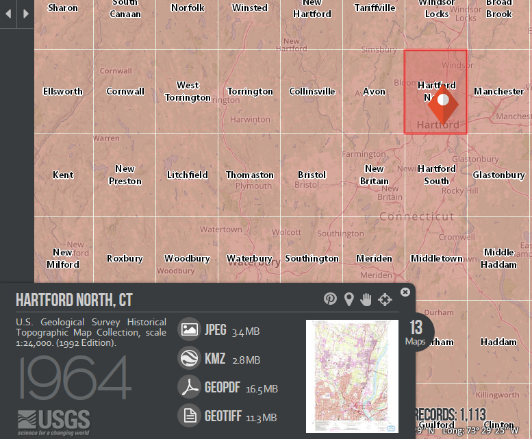
UConn MAGIC 2017
[xyz-ihs snippet=”Cody-income-inequalty”]


