Last week I wrote a post regarding the publication of the Times Atlas of the World. Since then, controversy has erupted over the amount of ice loss conveyed in Greenland. Glaciologists and climatologist around the world are are disputing the publisher’s claim that 15% of Greenland’s permanent ice cover has been lost since 1999. One hypothesis for the error is a misinterpretation of a contour lines on a 1999 map. Click here for more.
USGS Historical Topographic Maps
Nearly 90,000 high resolution scans of the more than 200,000 historical USGS topographic maps, some dating as far back as 1884, are now available on-line from the US Geological Survey. The Historical Topographic Map Collection includes published U.S. topographic maps of all scales and editions, and are offered as a georeferenced digital download or as a printed copy from the USGS Store.
Additional states (including Connecticut) will be added soon! For additional details and to access these maps visit: http://nationalmap.gov/historical/
History of Cartography Fellowship at U of Wisconsin-Madison
Complete information and application instructions are available at http://www.geography.wisc.edu/histcart/#fellow
GPS…One Billion Seconds Old!
On September 14, the atomic clocks that enable the Global Positioning System (GPS) struck 1,000,000,000 seconds. GPS was pioneered by the Department of Defense who set the beginning of GPS time on January 6, 1980. It wasn’t until the early 2000’s that GPS became widely available commercially. Before this, the DoD guarded this technology closely and did not allow the system to give civilians precise and accurate readings. This changed when, in 1996, then-President Bill Clinton signed an executive order to turn off Selective Availability (which became effective in 2000). GPS is now used for a wide variety of purposes including military, car navigation, recreation (see: Geocaching) as well as scientific research.
The Times Comprehensive Atlas of the World Released
The Times Comprehensive Atlas of the World was published this month. Although some political lines have been redrawn in the last four years since the previous edition (i.e. South Sudan), the most glaring differences, according to Ben Jarvey of Onearth, are the results of climate change. Jarvey cites differences in Greenland’s coastline because of receding ice (including a new island), receding seas in the Middle East (Aral and Dead Seas), and the collapsing of ice shelves in Antarctica as the major changes. For more climate related content, visit the Climate Resource Exchange Blog.
GIS Day 2011 – Call for Presenters
The 34th Americas Cup
The America’s Cup World Series is already underway and the competition has already met in Cascais, Portugal and will meet again at Plymouth, United Kingdom September 10th – 18th. Below is the course map and the venue map, should you be lucky enough to attend:
 |
| Map of Plymouth Course via Americas Cup |
 |
| Plymouth Venue Map via Americas Cup |
If you’re not so lucky but still want to follow races and some great footage check out the Americas Cup YouTube Channel. Watch the below clip showcasing the new cataraman style of boats:
More to come on the Americas Cup as it progresses!
UConn CLEAR Fall Geospatial Training Course Schedule
History Pin: Generations of Photos Mapped
History Pin is a web application that allows users to share and access historical photos. Much like MAGIC’s collaboration with On The Line, History Pin preserves history through digitization and links it with geography in an accessible, web-based format that uses Google products.
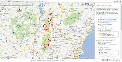
Yet Another Road Closure Map: Vermont
 |
| Google Maps serves as the base map while the VT Agency of Transportation provides the data for this map of road closures in Vermont. |


