Map of the Week! #3 Hartford in 1640 and 1893

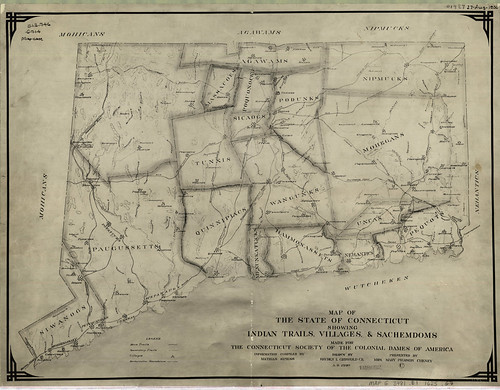
Today’s featured map was made in 1838 and shows landowners in Hartford in 1640, shortly after the city was founded. Initially, a pastor named Thomas Hooker led a group of about 100 people from Cambridge, Massachusetts to Connecticut to form a new colony. They chose present day Hartford as their new settlement site.

In 1639, government officials of Connecticut colony, including Thomas Hooker and John Haynes, created a document called the “Fundamental Orders of Connecticut.” It is arguably the first written constitution in Western society, and helped give Connecticut the nickname of “the Constitution State”. The document emphasized individual rights and democracy.

The second map comes from the Connecticut State Atlas in 1893. The 1893 street network in Hartford is generally the same as today, but the river going through the southern part of the city (called the Little River in the historic maps, now called the Park River) is completely removed from maps and aerial photographs today. So what happened to it? In the 1940s, the Army Corps of Engineers rerouted the river through underground concrete channels in an effort to control flooding in Downtown Hartford. Click below to view a recent New York Times article about the underground Park River.

http://www.nytimes.com/2003/07/31/nyregion/paddling-hartford-s-scenic-sewer-abused-underground-river-up-close-noxious.html

The screen below shows the historic maps from 1640 and 1893, as well as recent aerial photos. Click the box that says “Famous Historical Residents” in the upper right of the screen to view where famous early Hartford residents lived in 1640.

List of landowners and corresponding land parcel numbers for 1640 map (click to enlarge):

To view the 1640 map in flickr, click here: http://www.flickr.com/photos/uconnlibrariesmagic/3836896031/

To view the 1893 map in flickr, click here:
http://www.flickr.com/photos/uconnlibrariesmagic/3837687450/

Links about the early settlers of Hartford:
http://www.hartfordhistory.net/faq.html

http://en.wikipedia.org/wiki/History_of_Hartford,_Connecticut

How in the World? #3 – Georeferencing

In our first “How in the World” we showed you how a paper map is scanned and converted into a digital image. The map has geographic information drawn on it, but once it’s scanned it’s still just a picture. How can we place the image so that its extent is defined in physical or geographical space? We georeference it, that’s how!

Remember our Map of the Week featuring Sachemdoms, villages and trails? It began as a paper map, now it’s a digital masterpiece! All it took was:

  • A vector file (most commonly referred to as a Shapefile or Coverage)of Connecticut with latitude and longitude information stored within,
  • Our scanned Image,

  • And GIS Software.

Basically, we display both images on the computer screen and stretch them so the boundaries match and then tack them in place. When we tell the software to save the original paper map image, it also saves the latitude and longitude information with it. This information allows us to use it in other GIS programs or Google Maps! Watch this video to see how we georeference a paper map!

IT’S MAGIC!
~Jeff

Map of the Week! Connecticut Tribes Circa 1625

” Map of The State of Connecticut Showing Indian Trails, Villages & Sachemdoms Made for The Connecticut Society of The Colonial Dames of America

On this map made in 1930 we can see 19 Native American Sachemdoms of 1625 delineated in, and around the state of Connecticut. What exactly is a Sachemdom? It’s the territory of a Sachem. OK, so what exactly is a Sachem? A Sachem is the title of leadership in a Native American Tribe…so tying it all together a Sachemdom is the territory of a particular Native American Tribe under the leadership of Sachem. Got it?

So which 19 Sachemdoms are featured on our map? Here’s a list with links to informational websites. These sites are by no means the singular authorities on each tribe but it should make it easier for you to get a head start when gathering your own information!

Mohicans
Paugussetts
Siwanogs
Agawams
Massacoes
Tunxis

Quinnipiacs
Menunkatucks
Wangunks
Sicaogs
Poquonocks
Podunks
Hammonassets
Nehantics
Uncas
Mohegans
Nipmucks
Pequots
Wutcheken

Along with the tribe names listed above you will notice that there are major trails and pathways delineated on the map as well. What kind of impact do these trails and pathways have today? Examine the following map, toggle on the railroad layer located on the right. Do any of the railroad tracks line up with the trails? What other modern day features do you think would follow these trails?

Click the above image to View Interactive Map Mash-up

Thanks to Benjamin Spaulding for the education and assistance in creating this mash-up!
Also of interest is the following related reading material:
Trumbull, James H. Indian Names of Places, etc. In and On the Borders of Connecticut: With Interpretations of some of them. Hartford : Press of the Case, Lockwood & Brainard Co., 1881

Use the search tool to find instances of the tribes or villages that are featured in the map in the text of James H. Trumbull’s book!

James Hammond Trumbull was born in Stonington, Connecticut in 1821 and died in Hartford, Connecticut in 1897. He was the Assistant Secretary of State for Connecticut, the Connecticut State Librarian, President of the Connecticut Historical Society and was elected to the National Academy of Sciences.

For more information on James Hammond Trumbull, try this link to the National Academies Press.
OK, one map, lots of information. Thanks for stopping by!
~Jeff

How in the World #2

How in the world can the average person access GIS data just as easily as mapping professionals?

In the last “Did You Know?” We introduced GIS (Geographic Information Systems), how it works and what it is used for. Today we would like to show you how to retrieve and view GIS data. You might ask yourself how you can do this without specialized GIS software. No worries, we’ll show you how. All you need is your internet browser!

First, navigate a separate internet browser window to http://magic.lib.uconn.edu/ , once there click on GIS Data located on the top navigation bar

On the next page you will see several icons shaped like the state of Connecticut with categories listed beneath. Today we’re not interested in roads or political boundaries, Brandon and Jeff are going fishing! Jeff knows there are lots of boat launches on the coast but he can’t remember if there is one near Point Bluff State Park. To find out if there is a boat launch click on the Places data category on the right hand side:

This will take you to the places data on the GIS Data page where you’ll find a GIS data layer for Boat Launches! Listed information includes the date, the source (in this case the Connecticut Department of Environmental Protection), and data formats. Today lets preview this data in Google Maps, so on the right hand side of the screen click on the map preview icon:

Your internet browser will now display all of Connecticut’s boat launches in Google Maps:

Let’s check out if Bluff Pont State Park has a boat launch, look at the listing of boat launches on the left, Click on Bluff Point Boat Launch. A balloon will appear on the map giving the location of the boat launch. So we’re done right? We now know that there is a boat launch at Point Bluff State Park. But what if we need bait or fishing tackle while we’re out fishing? Let’s use Google Maps to find out.

On the Bluff Point Boat Launch Balloon, click search nearby. In the text box type Tackle Shop then click the search button.

Google Maps will now display all the tackle shops in the vicinity of the Bluff Point Boat Launch. By clicking on any of the markers a balloon will display the tackle shops name, address, and phone number. You’ll also have the option to get driving directions!

Congratulations, you are now an experienced GIS user! In this exercise you have loaded, queried, and analyzed a GIS data layer! Now you can experiment with MAGIC’s other data layers and have fun making maps. Now you can love geography as much as Brandon and Jeff do!

How in the World?

How does an old paper map become a digital image that can be used on the internet and in GIS?

First the map is selected and brought back to Brandon’s work station


Brandon carefully aligns the map in the scanner so it is nice and straight


After the map has been loaded into the scanner, Brandon tells the computer to scan the image

The scanner sends the digital information to his computer screen where an identical image of the paper map is created

Using software designed to adjust photos and images Brandon makes sure the image is straight and readable. The image is then saved and able to be viewed on computer screens.


In the next “How in the World?” we’ll show you how we give the scanned map geographic reference data so that it can be used in a GIS.

Map of the Week! London in 1776

London in 1776 (Click link below to view full sized map)

http://www.flickr.com/photos/uconnlibrariesmagic/3789830058/

The featured map this week is a 1776 city map of London, making it as old as the United States! It is found in a book called “A new and universal history, description and survey of the Cities of London and Westminster, the Borough of Southwark, and their adjacent parts” by Walter Harrison. As the title suggests, the book outlines the history of London and contains numerous drawings and maps of the city. There are many interesting locations displayed on the map, including:

London Bridge – Made famous by the nursery rhyme, London Bridge in the late 18th century was one of three places to cross the River Thames in the city. Harrison’s book featured drawings of the bridge in 1776, as well as drawings of when the bridge had buildings on it in the 1750s. London Bridge was torn down and rebuilt in 1831, and then again in 1972. The entire 1831 bridge was purchased in 1968 by an American named Robert McCulloch for two million dollars. McCulloch moved the bridge to Lake Havasu City in Arizona, where it is now the state’s second most popular tourist attraction.

Drawing of London Bridge from 1616 with buildings on it. The gate at the end of the bridge has the spiked heads of executed prisoners above it.

London Bridge in Lake Havasu City, Arizona

Tower of London – One of the most famous landmarks in London, the Tower of London was built in 1078 and has been used for torture, imprisonment, and storage of England’s crown jewels. Famous prisoners at the tower of London include Sir Walter Raleigh and Saint Thomas Moore.

Tower of London

Buckingham Palace – Currently home to the British monarch, Buckingham Palace was simply known as the “Queen’s Palace” in the late 18th century. The palace was greatly expanded and renovated in the early 19th century.

Buckingham Palace in 2009

Buckingham Palace in 1710, referred to in the map as the “Queens Palace”

Introducing Outside the Neatline!

About Outside the Neatline:

Outside the Neatline is a collaborative effort of graduate students who work at The University of Connecticut Libraries’ Map and Geographic Information Center (MAGIC). Our aim is to give the public a better understanding of what we actually do all day besides high-fiving each other when we find a neat new map. What we actually hope to illuminate is the usefulness of historic maps, digitally storing and displaying paper maps, and how they may be used in current mapping technologies.

Things to look forward to from Outside the Neatline include:

  • Featured Map of the Week – The staff’s favorite picks.
  • How in the World? – How the graduate students turn paper maps into digital wonders.
  • Did You Know? – General geography facts, definitions, and other tasty tidbits.
  • And More! – We’re open to suggestions, what do you want to see?
The main objective of Outside the Neatline is to provide our audience geographical knowledge in a fun and lighthearted way. So we hope you enjoy your visits to our site and please feel free to make this an interactive experience!

About the Authors:


Jeff Dunn earned his M.A. in Geography at West Virginia University and is currently a PhD student of Geography at the University of Connecticut. During semester breaks he works at MAGIC as a GIS Analyst scanning maps, georeferencing, and developing geography curriculum. Jeff’s specific areas of interests are in remote sensing and coastal geography. Outside of academics, Jeff is an avid fly fisher.


Brandon Cramer is a PhD student in Geography at the University of Connecticut. He received his M.A. in Geography from the University of Connecticut in 2008. Brandon is mainly interested in using geography to examine environmental and health issues. He has worked with government agencies to reduce agricultural pollution and analyze geographic disparities in disease and illness. Over winter and summer breaks Brandon is a GIS Analyst at MAGIC and works on scanning and georeferencing current maps and creating custom maps to fit users’ needs by special request.