A Spatial Revolution in the Humanities

Geospatial Technology, particularly in the past decade, has become more intuitive and user-friendly. This, in turn, has catalyzed the growth of a community of users that span a wide range of disciplines. Here, at the University of Connecticut Libraries’ Map and Geographic Information Center (MAGIC), much of what we work on is related to producing or preserving historical spatial data. This includes digitizing and georeferencing historical maps, producing cartographic layers from historical census data and making historical aerial imagery available to the public. We hope that by doing this, we can not only be of service to the traditional users of GIS, but also to those who are breaking new ground and finding novel applications for spatial analysis.

A Viewshed Analysis showing General Robert E. Lee’s perspective on the second day of fighting at Gettysburg. This recent NYT article describes research done at Middlebury College by Geographer Anne Kelly Knowles

The disciplines comprising the humanities, including but not limited to Anthropology, History, and Literature, have recently shown an affinity toward employing spatial analysis techniques. This New York Times article has received much attention lately, as it highlights the use of GIS by scholars to improve their understanding of historical events (such as Gettysburg and The Dust Bowl). A project at the University of Virginia Library, entitled Spatial Humanities, works to encourage this integration of spatial technology in the humanities. In May 2010, the UVA Library hosted an event “The Scholars’ Lab/NEH Institute for Enabling Geospatial Scholarship”. Follow this link to view two minute, three slide Lightning Talks from this event for more examples of spatial humanities projects and works in progress.

Spatially-enabling the humanities is not limited to scholars, however, and Google products have become a great tool for integrating a spatial dynamic for K-12. Google Lit Trips, which is a project that compiles cartographic layers related to Literature, is a great example of this.

At the University of Connecticut, we hope to do our part in contributing to this digitally-enabled spatial revolution in the humanities. Over the past two years, MAGIC has worked closely with Professor Jack Dougherty from Trinity College to produce cartographic products for On The Line: How Schooling, Housing and Civil Rights Shaped Hartford and its Suburbs.

Redlining, or discriminatory lending practices by geographic area, was a driving factor that shaped the Hartford Region. MAGIC helped to produce cartographic layers for On The Line that visually portray these policies.
This web book, supported by a grant from the National Endowment for the Humanities, has been a collaboration between historians, geographers, librarians, technology specialists and students. My colleagues and I at MAGIC have had the opportunity to produce innovative digital maps for this project, some of which have been highlighted in our recent, and ongoing, blog series highlighting our partnership with Jack. In case you missed them, follow these links and stay tuned for more!

Interactive Map Shows States’ Renewable Energy Goals

Interested in finding out more about renewable energy policies in your state? Climate Central recently published this interactive map of Renewable Portfolio Standards by state. Renewable Portfolio Standards (RPS) are voluntary goals that many states’ have established to encourage the adoption of clean and renewable energy sources. For more information regarding RPS, visit this EPA website.

Population Services International (PSI) Employs GIS To Improve the Health of the Poor and Vulnerable in Developing Countries

PSI’s Interactive Map shows the organizations Areas of Interest

PSI is a global non-governmental organization (NGO) that works to reduce the amount of suffering by people in the developing world due to reproductive health and non-communicable diseases. One research approaches that PSI employs in order to ensure the most effective use of resources is Measuring Access and Performance (MAP). A cornerstone of this approach is to recognize the relationship between the population’s need and the delivery system coverage and quality. This inherently geographic approach uses GIS to determine whether or not supply for services is meeting the demand. PSI is able to do this because of an agreement with the World Health Organization that allows PSI to access data and software crucial to the spatial analysis. 

Geospatial Technology Is Enabling Better Power Management in California

According to this Reuters article, Geospatial Technology has enabled real-time management of electricity in California. What does this entail? For one thing, a control room equipped with “an 80 foot by 6.5 foot screen” to display the power grid in real-time. Software developed by Space-Time Insight, which uses Google Maps as a base map, allows employees at The California Independent System Operator Corporation to manage power supply in addition to determining what source of power will be cheapest for specific locations. One example this article cites is how California ISO was able to divert power flow away from areas affected by wildfires in San Diego in 2008.

Crisis Management with Mobile Applications

Check out this article that details a “Crisis Management App” that first responders in Marietta, Georgia use in emergencies. The application, developed with ESRI’s ArcView 10 and Adobe Flex, is designed to be used by non-GIS experts. Although it is designed for easy functionality, the capabilities of the application remain rich. Users (first responders) can add features, such as incidents and roadblocks in addition to accessing imagery and live video stream.

Also, be sure to check out this CNN article that details the growing use of Social Media in times of disaster. Russ Johnson, the director for public safety and homeland security for ESRI, is quoted throughout the article describing how these tools can help emergency resources be deployed more efficiently in time sensitive situations.

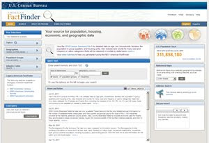
August 2011 – New American FactFinder Workshops at UConn Storrs

Are you interested in downloading and using 2010 U.S. Census for Connecticut and having trouble using the New American FactFinder? Are you interested in learning more about how to use the New American FactFinder to access data from the 2010 U.S. Census? The Connecticut State Data Center is offering workshops at the University of Connecticut Storrs Campus to provide users with an opportunity to learn more about the New American FactFinder in a hands-on workshop environment. Included below are the upcoming workshops dates/times and registration links:
Workshop Dates:
August 9, 2011 from 10:00am-11:30am
August 11, 2011 from 1:00pm-2:30pm
August 12, 2011 from 10:00-11:30am
These workshops are free and open to the public.
Workshop Location:
Each of these workshops are being held at the University of Connecticut Homer Babbidge Library on the Storrs Campus in Electronic Classroom 2 on Level 2 of the Homer Babbidge Library. Parking is available in South Parking Garage (located just behind the UConn Co-op) and parking costs must be paid in cash upon exiting the garage.
Space is limited so register early and feel free to share this announcement with anyone that may be interested in attending this workshop. Additional sessions of this workshop will be offered over the coming months, so be sure to check the Connecticut State Data Center’s website for the latest events (http://ctsdc.uconn.edu). 

2011 GIS in Public Transportation Conference Announced

The Urban Regional Information Systems Association (URISA) and the University of South Florida’s National Center for Transit Resarch at the Center for Urban Transportation Research (CUTR) have announced the details to the 2011 GIS in Public Transportation Conference, which is September 13-15, 2011 at the Hilton Bayfront in St. Petersburg, Florida. The conference is still accepting poster submissions.

For more information click here!

Frontlines Highlights How USAID Implements Geospatial Technology

The June/July 2011 edition of USAID’s Frontlines advocates the use of Geospatial Technology in humanitarian causes. These four articles describe how GIS and Remote Sensing are being applied in the US’ international development efforts:

Open Geospatial Consortium 3D Management Group to Host Second 3D Summit

Home

The Open Geospatial Consortium, a non-profit dedicated to leading the way for standardizing geospatial and location based services, is hosting its 2nd 3D summit September 20, 2011 in Boulder, Colorado. Abstracts for presentations are due Friday, August 12, 2011. Other important dates are as follows:

  • 12 August 2011: Abstract submissions for Lightning Talks and Video Presentations
  • 12 August 2011: Notification on accepted contributions
  • August 2011: Program Announcement
  • August 2011: Registration Available
  • 12 September 2011: Final Video Submissions
  • 20 September 2011: 3D Summit 2011 at the OGC Technical Committee Meeting