Did You Know #19 Gowalla

If you have an iPhone and frequently use the social networking sites Twitter and Facebook then the Gowalla application is for you. This application enables users to share and locate restaurants, cafes, landmarks, parks, museums and other social environments. Users can add a location on a map using the iPhone’s GPS capability, add comments about the location and enables others to comment and share their experiences. If you use Twitter and have enabled geotagging you can share you location via Twitter from the App.

This is a truly social application and is Free for download from the iTunes store (at least free as of this posting on December 9, 2009) and is a great example of the crowdsourcing model for information creation.

This application is just one of many recently released iPhone Applications that utilize the location awareness capabilities of the iPhone (thanks to GPS) and social networking and blend them into one application.

This application was brought to our attention via our RSS feed from Tech Crunch.

Opportunities #2: CaGIS Scholarships

Applications for the 2010 Cartography and Geographic Information Society (CaGIS) scholarships are being accepted until January 15, 2010. Candidates must be enrolled full-time in a four-year undergraduate or graduate degree program during 2009 or 2010, studying cartography, geographic information science, or a closely related field. Awards range from $500 for masters degree seeking students to $1,000 for PhD degree seeking students.


For additional details visit: http://www.cartogis.org/awards/cagis-scholarships/scholarship

Did You Know #18 Natural Earth

We know it is crunch time for many GIS students out there as the semester is nearing the end so try Natural Earth for obtaining Free GIS Data (that’s right Free!) for areas beyond Connecticut. Natural Earth is an online GIS data warehouse which includes public domain map dataset at 1:10m, 1:50m, and 1:110m scales. Data appears to have both a United States and International focus with cultural, physical and raster datasets. The interface is intuitive and easy to navigate based upon our exploration of the site. Check out this site and let us know what you think!


Special thanks to Maps, Air Photo & GIS Forum Listserv for sharing this resource!

Opportunities #1: Newberry Library Fellowships

This is the first posting of a new series we are adding to Outside the Neatline to share opportunities for grants, fellowships, presentations, and publishing. The Newberry Library in Chicago, Illinois [map it] has a short term and a long term fellowship opportunity for to conduct research using their vast collections.

For short term fellowships, PhD and post-doctoral scholars are eligible and awards are typically for one month periods. Stipends are $1600 per month.

For long term fellowships, are designed to support research and writing by scholars with a doctorate for a range of 6-11 months. Stipends are up to $50,400.

Full details on the Newberry Library Fellowships are available at the following link.

Did You Know #17 Bing Maps Beta

Microsoft’ Bing Maps latest release is now officially in beta for users to try. This new version of Bing Maps using the Microsoft Silverlight platform and requires a user to install silverlight before they can use the new interface. Many users might be familiar with the Microsoft Silverlight platform as it is being used to provide access to streaming video content and other interactive media and is similar to Adobe’s flash media player.

Bing Maps Beta includes:
– Streetside View (Similar to Street View in Google Maps)
– Multiple Perspective Aerial Images (just as in the previous version)
– Streetside includes simulated 3D which in dense urban areas provides a realistic view of the area in 3D.
– Navigation controls are easier to find and rotating the image is extremely fast
– Bing Map Apps provide integration for Twitter and other data feeds

Below is a screen shot of Bing Maps Beta taken on December 3, 2009. As you can see the interface is more streamlined, includes weather data, and great color imagery.


For more details visit the Tech Crunch Blog for more details and reviews of Bing Maps Beta.

Did You Know #16 Interactive Timelines

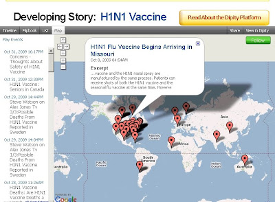
When developing research projects, a timeline of events can be extremely helpful for illustrating the sequence and inter-connectivity of concepts. Dipity is an online resource which enables you to create interactive timelines and includes a timeline, flipbook, list and map view. On the main page the site includes a top news story theme and provides an interactive timeline of events. Below are some examples of the Timeline and Map functions in Dipity related to the H1N1 Vaccine.


The dipity website also enables you to create a login where you can add content from Flickr, and RSS feed, blogs, YouTube, Twitter, and several other sources dynamically. You can even create individual events and add them to the timeline. Once you have created your timeline, post the link to Twitter, Facebook, Myspace, or embed the timeline widget on your own website!

Have fun experimenting with this site and share your feedback with us below.

Special Thanks to Steven Park from the University of Connecticut Learning Resource Center for sharing this link with us.

Did You Know? #15 GeoMentor Seeking Educators

Outside the Neatline (overseen by the University of Connecticut Libraries Map and Geographic Information Center) is seeking a GeoMentor relationship with formal(public/private schools) and informal educators(Boy Scouts, Girl Scouts, etc…) in the state of Connecticut. What exactly does a GeoMentor do?

“A GeoMentor ‘adopts’ a school, class, or club and supports the educator/s in working with youth. Using tools of geography (such as maps and globes, atlases, charts, imagery, and field work), the GeoMentor helps the educator and youth develop skills in geographic thinking.” ~ GeoMentor.org

Since Outside the Neatline is integrated with MAGIC we can offer access to one of the nations premier map collections, online geospatial data, knowledgeable mapping professionals. We are eager to create learning opportunities that provide interdisciplinary research and learning experiences.

Please watch the video below featuring the release of the GeoMentor program and visit the website to learn more about the program at http://geomentor.org

If you have any interest or questions concerning the program please contact Jeff Dunn at:

jeffrey.dunn@uconn.edu
or
magic@uconn.edu

Please use “Outside the Neatline” in the subject line for both addresses.

Map of the Week #7 – Montana 1911

State of Montana – Department of the Interior General Land Office Map – 1911

While searching for maps of Yellowstone National Park, this gorgeous map of Montana was discovered while exploring the map collection at MAGIC. This 1911 map includes Indian Reserves, National Parks, Reclamation Projects and U.S. Land Offices as well as several other features.

This map includes railroad lines and it is clearly visible that the Northern Pacific Railroad has a spur line which provides passengers with access to Yellowstone National Park. The desire to connect Yellowstone via rail is clearly evident in the History of Northern Pacific Railroad by Eugene V. Smalley in1883 which is included below.

Explore this map in the original size view (this may take a few moments to load) and share the amazing features relevant to your research with us by posting a comment.

Did You Know? #14 Holy Bjerknes! El Nino in the News.

“The sky is falling! …err… I mean… Balloon Boy is coming!”
No, nothing as eventful as that… What I really meant to say is “El Nino is coming! “

Thankfully, there is no need to wonder if your life will be impacted. The National Oceanic and Atmospheric Administration(NOAA) has released their winter outlook report highlighting the effects of the latest El Nino-Southern Oscillation (ENSO) event. Not sure what ENSO is all about? The below animation shows what happens to ocean water temperatures and heights in the Pacific Ocean during an ENSO event. Following the animation is a link that will take you to a site that describes ENSO in more detail.

Follow this link for a description about the events that take place during an El Nino.

If you’re living in New England, don’t blame the weather on ENSO! Check out the maps below created by NOAA to see which areas of the United States will be affected. Oh yeah, Want to know what that “Holy Bjerknes” business is all about? Click Here!

Did You Know? #13 European Union


Historical maps from a large selection of libraries in the European Union are now available to search and download from Europeana. Europeana links you (the world) to over 4.6 million digital items from collections that include the Rijksmuseum in Amsterdam, the British Library in London and the Louvre in Paris. Oh, and if maps are not your thing there’s art, text, audio and video there too!